Remote Sensing Services: Precision Data Collection and Analysis
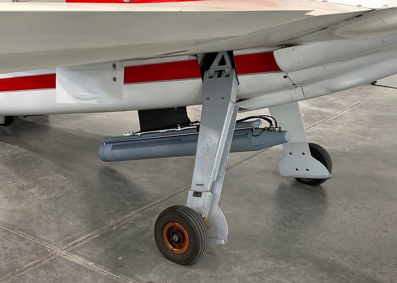
Aerovehicles as an operator provides a wide range of surveying, reconnaissance, monitoring, and remote sensing services, using the latest technology and state-of-the-art equipment. Our team provides precise and reliable data for applications in mapping, environmental monitoring, agriculture, forestry, and more. Utilizing advanced systems such as LiDAR and Synthetic-Aperture Radar (SAR), we deliver actionable insights in real-time for industries that require high-quality data.
Synthetic Aperture Radar (SAR)
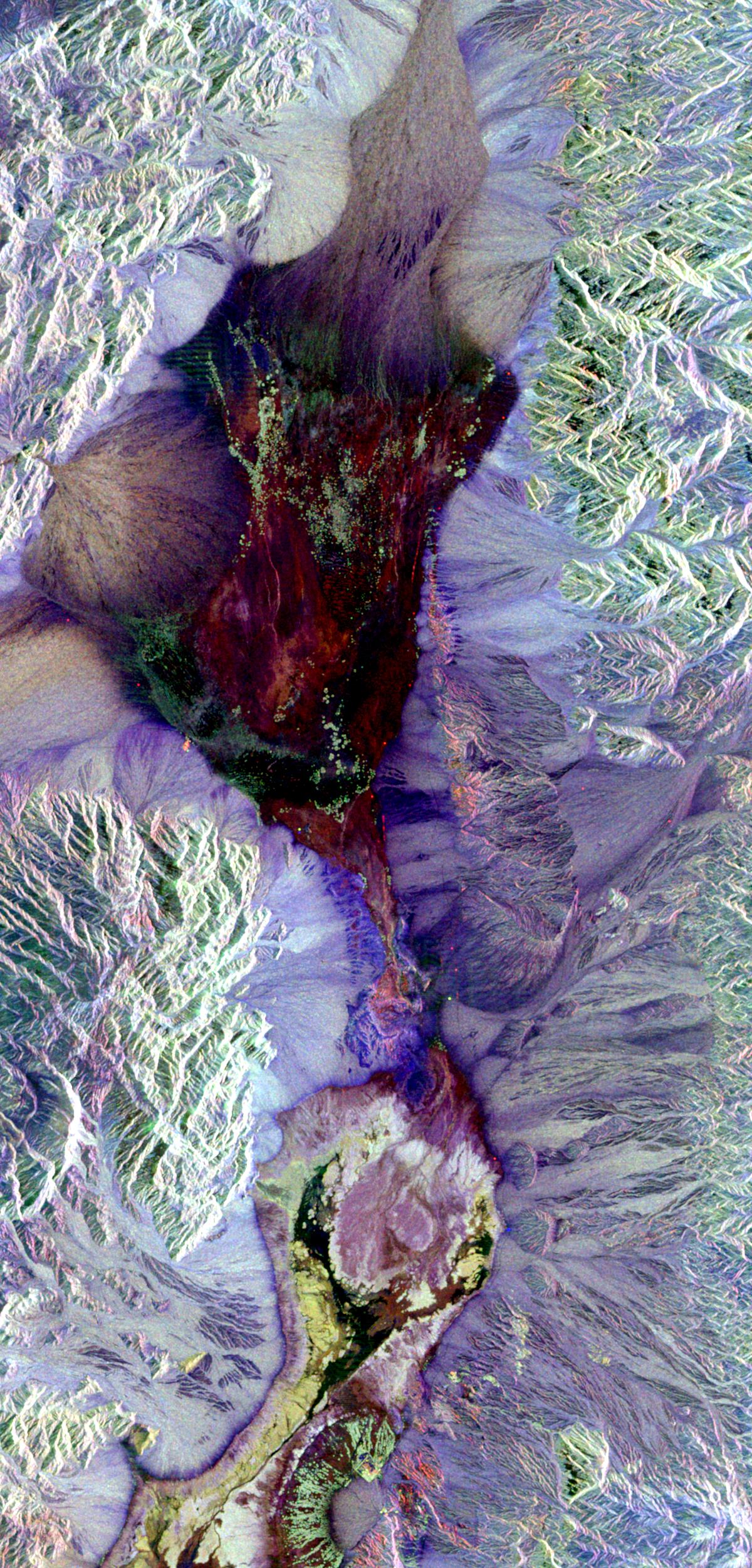
Is an advanced radar technology that uses motion to create high-resolution images of objects or landscapes, even through clouds, rain, or darkness. By moving the radar along a flight path. SAR captures data from multiple angles, synthesizing them into a detailed image that mimics a much larger antenna, or “synthetic aperture.”
Flying from an aircraft, the level of detail is higher than satellite imagery.
- Mapping and Surveying: SAR provides detailed maps of large areas, capturing terrain, vegetation, and structures. Its radio waves penetrate clouds, making it effective in all weather.
- Environmental Monitoring: SAR tracks changes in vegetation, water bodies, and natural features, aiding in monitoring forest health and environmental shifts.
- Agriculture: SAR measures crop height and health, helping to identify areas needing attention or treatment.
- Forestry: SAR assesses tree density, height, and biomass, supporting forest management and conservation efforts.
- Archaeology: SAR creates detailed maps of archaeological sites, revealing hidden structures beneath the ground.
- Transportation: SAR maps roads and highways, providing data valuable for planning, construction, and maintenance.
- Engineering and Construction: SAR produces 3D models of buildings and structures, assisting in design and planning.
- Geology: SAR maps Earth’s surface in detail, offering critical information for geological studies.
- Military and Defense: SAR is used for surveillance and reconnaissance, offering detailed insights into enemy positions and movements.
LiDAR – Light Detection and Ranging
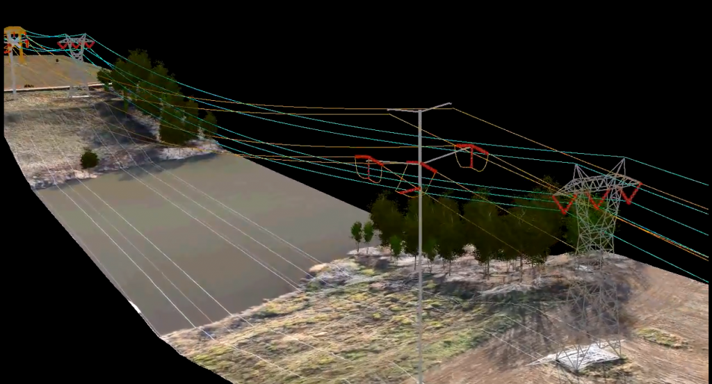
LiDAR (Light Detection and Ranging) is a remote sensing technology that uses laser pulses to measure distances. By emitting lasers and measuring the reflected light, it creates precise 3D maps of terrain, objects, and structures. LiDAR is widely used in mapping, environmental monitoring, agriculture, forestry, and autonomous navigation.
Flying from an aircraft, the level of detail is higher than satellite imagery.
- Mapping and Surveying: LiDAR creates precise maps of terrain, vegetation, and structures over large areas.
- Environmental Monitoring: LiDAR tracks vegetation health and changes in water bodies and natural features.
- Agriculture: LiDAR measures crop height and health, identifying areas needing special attention.
- Forestry: LiDAR assesses tree density, height, and biomass, aiding forest management.
- Archaeology: LiDAR maps archaeological sites, uncovering hidden features.
- Transportation: LiDAR maps roads and highways for planning and maintenance.
- Engineering and Construction: LiDAR generates 3D models of structures, supporting design and planning.
- Geology: LiDAR maps Earth’s surface, providing essential data for geologists.
- Military and Defense: LiDAR aids in surveillance, detailing enemy positions and movements.
Contact Us
For more information on how our remote sensing services can support your project, [contact us].